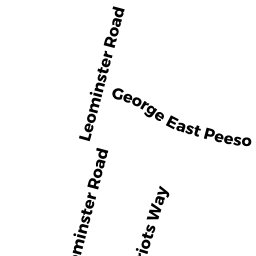
129-135 LEOMINSTER ROAD
Owner Information
STERLING TOWN OF
4 CHOCKSETT ROAD
STERLING, MA 01564


Property Details
129-135 LEOMINSTER ROAD is classified as a Unknown (Other municip).
The primary structure on this property was built in 2002. There are 9,363ft2 of built area within this property. There is 6,388ft2 of residential/living space within this property.
129-135 LEOMINSTER ROAD is valued at $2,429,500. The land is valued at $184,700 and the structures are valued at $2,244,500. There is an additional valuation of $300 on this property.
This property is in Zone LI. Confirm with local Zoning Board authorities to ensure there are no overlays or other easements on this property.
The most recent deed for 129-135 LEOMINSTER ROAD is recorded at the local registrar in Book 06050, Page 0084. 129-135 LEOMINSTER ROAD was last sold on Wednesday, October 20, 1976 for $0.
Assessment data from fiscal year 2022.
Flood Data
According to the FEMA National Flood Hazard Layer, this property does not appear to be in a flood zone. It may also be in an area not yet reviewed. Nonetheless, confirm this information prior to taking any action.
To view the flood hazards around this property, create a FEMA "Firmette" Map of the area around 129-135 LEOMINSTER ROAD.
Broadband Internet Providers
| Provider | Type | Bandwidth (mbps) | |
|---|---|---|---|
| HughesNet | Satellite | 25 | 3 |
| T-Mobile | Fixed Wireless | 25 | 3 |
| PAETEC Communications, Inc | DSL | 0 | 0 |
| Comcast | Cable | 1000 | 35 |
| Verizon New England Inc. | DSL | 15 | 1 |
| Viasat Inc | Satellite | 100 | 3 |
| VSAT Systems, LLC. | Satellite | 2 | 1 |
| GCI Communication Corp. | Satellite | 0 | 0 |
Broadband service provider data from December 2020.
Adjacent Properties
- 9C PATRIOTS WAY
Residential Condominium owned by HARTWELL CASSANDRA - 10C PATRIOTS WAY
Residential Condominium owned by JOHNSON, BRADLEY TAYLOR - 1A PATRIOTS WAY
Residential Condominium owned by CHAMBERLAND GARY M - 2E PATRIOTS WAY
Residential Condominium owned by BIDDY, DONALD C - 5A PATRIOTS WAY
Residential Condominium owned by GOW DAVID M - CHOCKSETT ROAD
Other, Non-Taxable Condominium Common Land owned by MHOC OF STERLING, INC. - 9A PATRIOTS WAY
Residential Condominium owned by DAVID BASHAW TRUSTEE 9A PATRIOTS WAY REALTY TRUST - 9E PATRIOTS WAY
Residential Condominium owned by JACOBS SUSAN M - 9D PATRIOTS WAY
Residential Condominium owned by TINGLE SHAY D - 9B PATRIOTS WAY
Residential Condominium owned by GARRY CRYSTAL R - 10D PATRIOTS WAY
Residential Condominium owned by CHAUDHRY, SUMAN - 10B PATRIOTS WAY
Residential Condominium owned by CATMEN THOMAS L - 10A PATRIOTS WAY
Residential Condominium owned by EMERTON JAMES - 1D PATRIOTS WAY
Residential Condominium owned by DRUZBICKI PAMELA A - 1C PATRIOTS WAY
Residential Condominium owned by FITZGERALD DENNIS H - 1B PATRIOTS WAY
Residential Condominium owned by HARDING JENNIFER M - 2D PATRIOTS WAY
Residential Condominium owned by HASTINGS MICHAEL J & ROBERTA G/TRUSTEES - 2C PATRIOTS WAY
Residential Condominium owned by DECICCIO DIANE - 2B PATRIOTS WAY
Residential Condominium owned by LAGE LINDA L - 3E PATRIOTS WAY
Residential Condominium owned by ESKOLA BRIAN - 3D PATRIOTS WAY
Residential Condominium owned by MATSIK STEVEN G - 3C PATRIOTS WAY
Residential Condominium owned by PETERSON CHRISTINE A - 3B PATRIOTS WAY
Residential Condominium owned by NOPONEN CHRISTINE - 3A PATRIOTS WAY
Residential Condominium owned by PARKS LORI A - 4E PATRIOTS WAY
Residential Condominium owned by NEKERVIS MELINDA A - 4D PATRIOTS WAY
Residential Condominium owned by THEODOSS AARON - 4C PATRIOTS WAY
Residential Condominium owned by BRIGGS JENNA - 4B PATRIOTS WAY
Residential Condominium owned by CAIRES OLGA - 4A PATRIOTS WAY
Residential Condominium owned by VINCENT JAMES CRISCI TRUSTEE - 5D PATRIOTS WAY
Residential Condominium owned by RIELLO ANTHONY JR - 5C PATRIOTS WAY
Residential Condominium owned by BRIAN SOARES - 5B PATRIOTS WAY
Residential Condominium owned by GUSTAFSON AMANDA L - 6D PATRIOTS WAY
Residential Condominium owned by BLEHAR ADAM - 6C PATRIOTS WAY
Residential Condominium owned by ANTUNES JULIE - 6B PATRIOTS WAY
Residential Condominium owned by GAFFNEY MARY - 6A PATRIOTS WAY
Residential Condominium owned by SHAKARIAN MICHAEL E & DEBORAH, TRUSTEES - 7D PATRIOTS WAY
Residential Condominium owned by BRIDEAU DOROTHY D - 7C PATRIOTS WAY
Residential Condominium owned by WALL, SANDRA ELIZABETH - 7B PATRIOTS WAY
Residential Condominium owned by ANTONANGELI JAMES - 7A PATRIOTS WAY
Residential Condominium owned by LAURIE E PICARD - 8D PATRIOTS WAY
Residential Condominium owned by RIBEIRO CAROL A - 8C PATRIOTS WAY
Residential Condominium owned by PASTERNAK ERIN - 8A PATRIOTS WAY
Residential Condominium owned by DOODY WILLIAM D - 8B PATRIOTS WAY
Residential Condominium owned by BAKER LORI A - 2A PATRIOTS WAY
Residential Condominium owned by RICHARD FRANCIS - 6E PATRIOTS WAY
Residential Condominium owned by CRISCI VINCENT J - CHOCKSETT ROAD
Dept. of Conservation and Recreation (DCR) - Division of Water Supply Protection owned by MASSACHUSETTS COMM OF (DPW) - 0 CHOCKSETT ROAD
Undevelopable Industrial Land owned by GARGULINSKI BENEDICT - 137-145 LEOMINSTER ROAD
Vacant, Selectmen or City Council (Municipal) owned by STERLING TOWN OF